Kakadu National Park Map
Posted on 26 August, 2021 in Wildlife, Waterfalls, Tours, Hiking, Kakadu, Private Charter, Rock Art, Darwin, Culture, Camping, Top End Locations, family, kids, EnvironmentTwenty thousand square kilometres of a living landscape. About the same size as one-third of Tasmania!
Kakadu National Park Map
Darwin to Kakadu
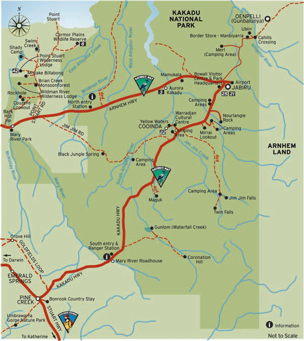
Driving from Darwin to Kakadu is about 150km via the Arnhem Highway, a sealed bitumen road. This will bring you to the edge of the park and the northern entrance to Kakadu National Park.
Heading east along the Arnhem Highway and cutting through the centre of our Kakadu National Park Map, you will pass through the South Alligator region. Forty minutes along the highway, make a short stop at Mamukala Wetlands, a bird lovers paradise. Continuing on the Arnhem Highway for about 30km, you will reach the main township of Jabiru.
East Alligator Region
About an hour northeast of Jabiru, you will arrive at the East Alligator River, the boundary between Kakadu National Park and Arnhem Land. Make sure you check out the crocodiles sunbaking at the notorious Cahills Crossing.
A Kakadu National Park visit is not complete without Ubirr Rock, also in the East Alligator Region. Known for its ancient rock art and breathtaking views, this can be a spectacular place to watch the sunset. Then, return to Jabiru, the perfect spot for an overnight stay with several accommodation options and all the essential services.
Nourlangie
Hit the road early, and head south from Jabiru on the Kakadu Highway and enter the Nourlangie region. Visit Nourlangie Rock and view ancient naturally protected rock art on the 1.5km loop walk. Also in this region is the Anbangbang Billabong. Kakadu's most picturesque.
Jim Jim and Twin Falls
Back on the highway and driving south for 30km, turn east on the Jim Jim access road towards the iconic waterfalls of Kakadu National Park - Jim Jim Falls and Twin Falls. (4WD access only). Allow a whole day here. Spend the day taking in the views and cool off in the deep waterfall pool at Jim Jim Falls. A further 10km away, you will reach Twin Falls. A shuttle can take you up the gorge. There is a campground in this area which offers a unique camping experience.
Yellow Water Region
Heading back to the Kakadu Highway and driving northwest to Cooinda, you can board a cruise and experience the majestic Yellow Water wetlands. Landlocked, this billabong is teeming with native flora and fauna.
Mary River Region
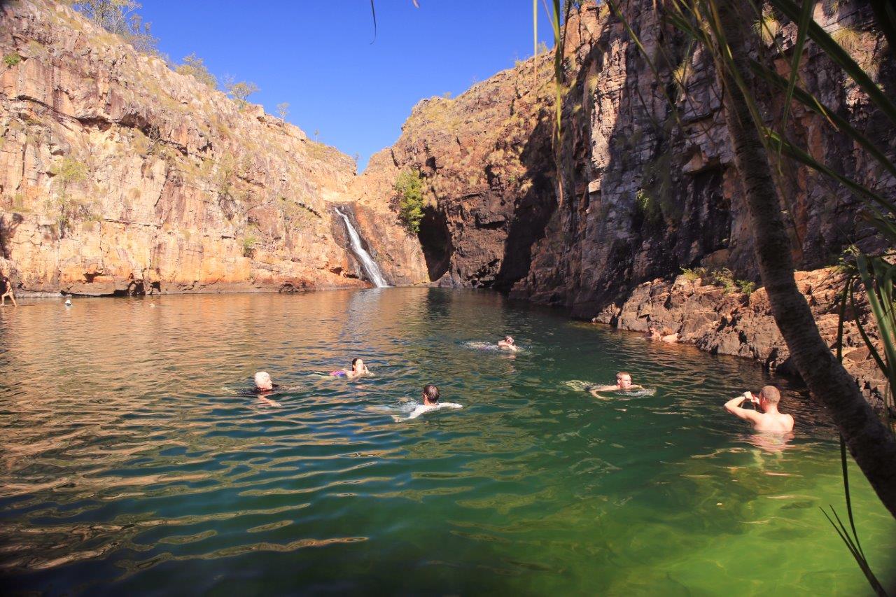
On the Kakadu Highway and continuing south to the Mary River region, visit Maguk (Barramundi Gorge) and Gunlom falls (4WD recommended). Cascading waterfalls spill into pristine natural pools.

Leaving Kakadu National Park
Continue south along Kakadu Highway, and you will exit Kakadu National Park via the southern entrance heading into Pine Creek. Drive south into Katherine to continue your outback adventure or return to Darwin. This journey completes a rough triangle through the centre of our Kakadu National Park Map.
With plenty of self-drive options, you can take things at your own pace. Kakadu National Park is expansive!! Always allow for plenty of drive time, check road access before you head off and try to avoid driving at night. Follow safety warning signs, especially when it comes to swimming. Visit the Parks Australia website for an informative Kakadu Access Report.
Or why not let someone else take care of the driving and join a Venture North 5day Kakadu, Arnhem Land and Cobourg Peninsula Tour. This small, guided tour runs May - October is a great way to combine Kakadu, Arnhem Land and Cobourg. We also offer private charters, which we can tailor to your areas of interest. So book or enquire with us today.
See you on the road!
© 2014 Venture North | ABN: 34 142 533 113 | Privacy Policy | Terms & Conditions
Darwin Web Design by Dash Media


